图文并茂--微信小程序,获取用户地理位置信息,并调用腾讯地图API来获取用户具体位置
2024-08-28 01:07:34
今天开始搞这个东西,下面是详细的记录
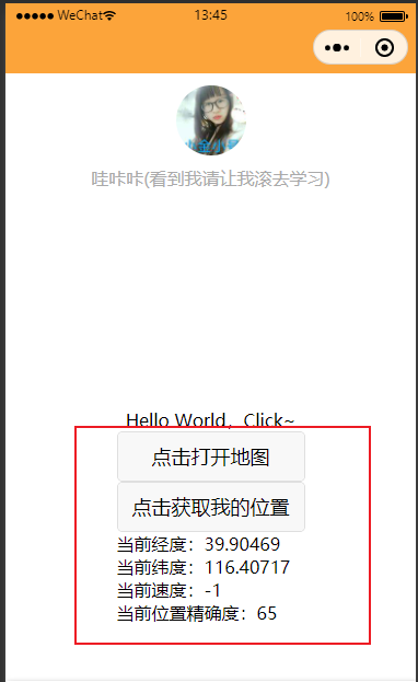
先看一下效果啦
1.小程序代码先获取用户基础位置信息
js
data: {

    myLocation: 'GET LOCATION',

      },

openMap() {

    var myThis = this

    wx.getLocation({

      type: 'gcj02', // 默认为 wgs84 返回 gps 坐标,gcj02 返回可用于 wx.openLocation 的坐标

      success: function (res) {

        // success

        console.log('获取位置2');

        myThis.setData({

          myLocation: JSON.stringify(res)

        })

        console.log(res.latitude);

        console.log(res.longitude);

        wx.openLocation({

          latitude: res.latitude, // 纬度,范围为-90~90,负数表示南纬

          longitude: res.longitude, // 经度,范围为-180~180,负数表示西经

          scale: 28, // 缩放比例

          name: "要找的地方名字(某某饭店)",

          address: "地址:要去的地点详细描述"

        })

      }

    })

  },

openMap1() {

    var myThis = this

    wx.getLocation({

      type: 'wgs84',

      success(res) {

        // 纬度,范围为 -90~90,负数表示南纬

        const latitude = res.latitude

        // 经度,范围为 -180~180,负数表示西经

        const longitude = res.longitude

        // 速度,单位 m/s

        const speed = res.speed

        // 位置的精确度,反应与真实位置之间的接近程度,可以理解成10即与真实位置相差10m,越小越精确

        const accuracy = res.accuracy

        myThis.setData({

          myLocation: '当前经度:' + latitude + '\n' + '当前纬度:' + longitude + '\n' + '当前速度:' + speed + '\n' + '当前位置精确度:' + accuracy

        })

        console.log(res.latitude);

        console.log(res.longitude);

      }

    })

  },
html
 <button type="default" bindtap="openMap">点击打开地图</button>

 <button type="default" bindtap="openMap1">点击获取我的位置</button>

 <text >{{myLocation}}</text>
app.json
"pages": [

        "pages/index/index"

    ],

 "permission": {

        "scope.userLocation": {

            "desc": "你的位置信息将用于小程序位置接口的效果展示"

        }

    },
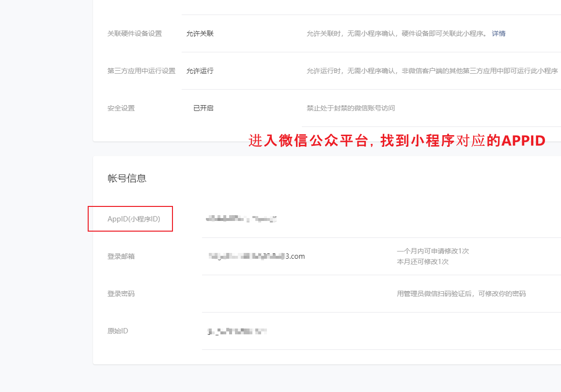
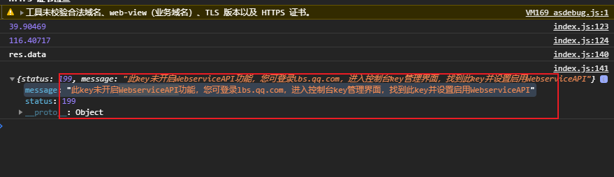
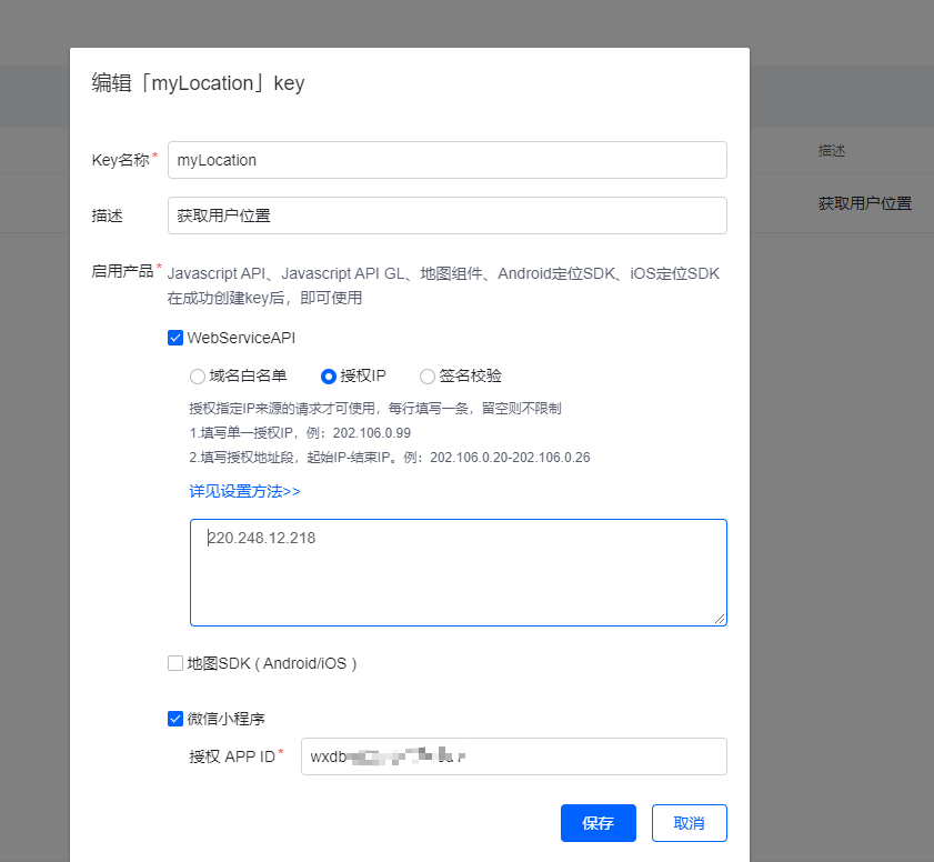
下面开始调用腾讯地图API进行解析我们的经纬度
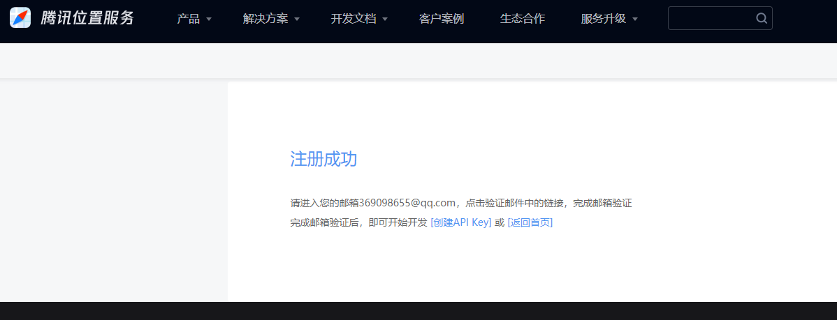
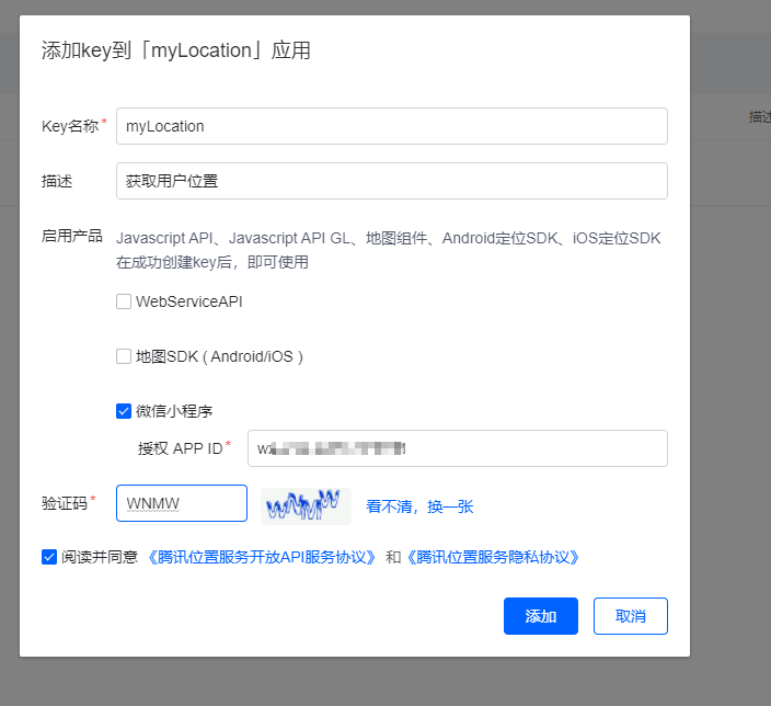
注册账号
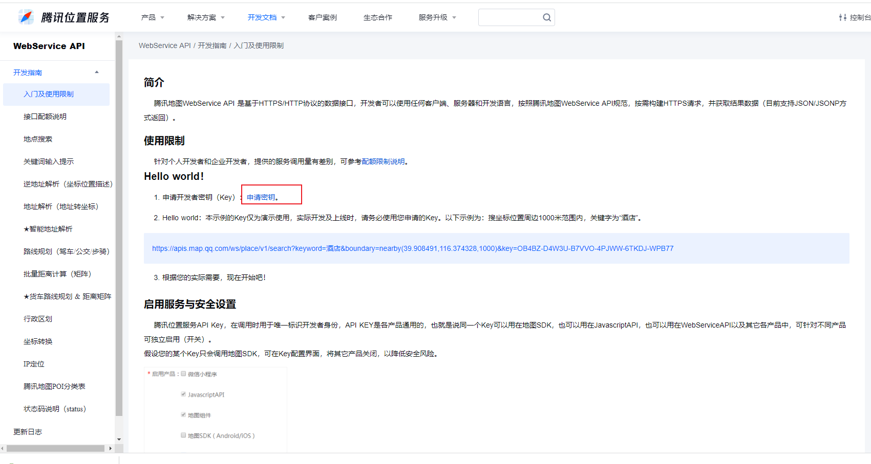
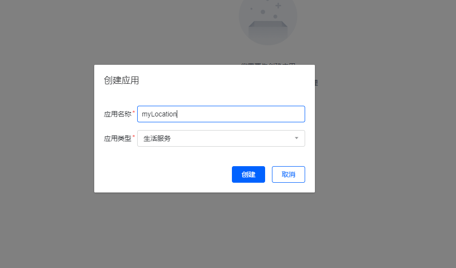
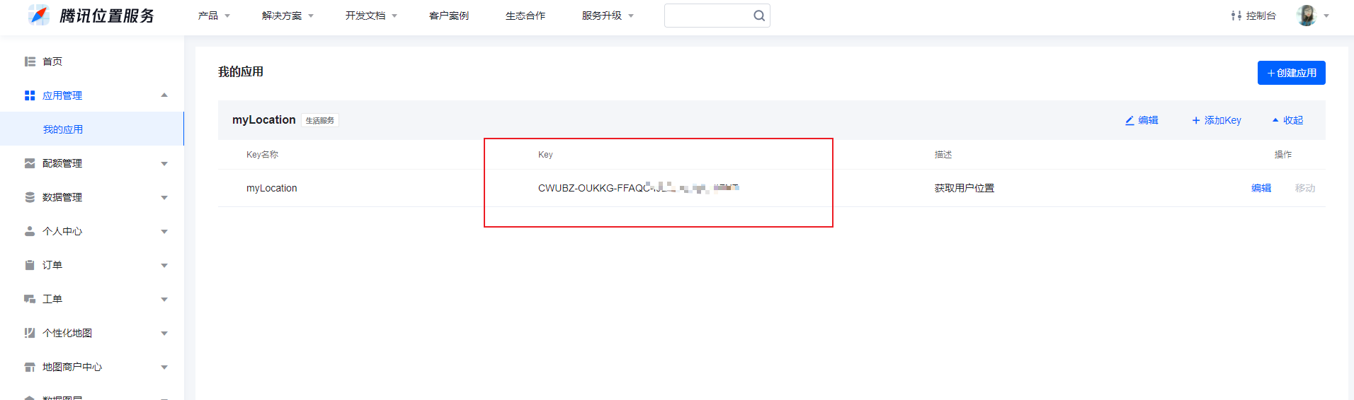
创建应用,获取KEY,
发请求进行经纬度解析
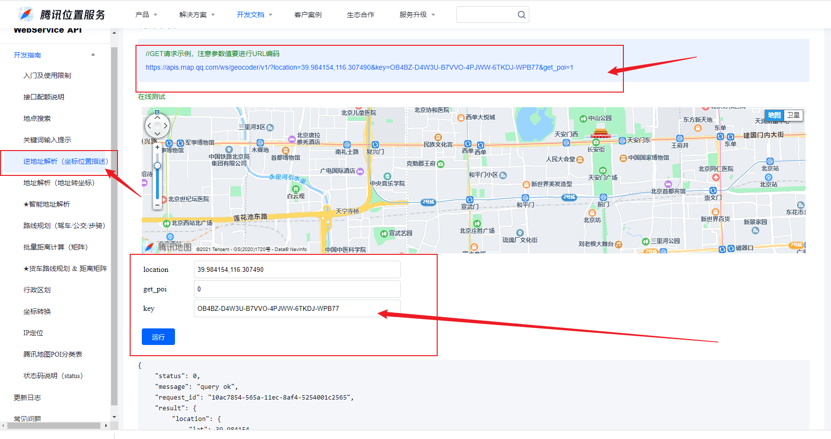

JS
最新文章
- 『.NET Core CLI工具文档』(一).NET Core 命令行工具(CLI)
- python(1)
- iOS 直播(一)
- iOS -iPhone5、iPhone5s、iPhone6、iPhone6Plus 屏幕适配
- 1934: [Shoi2007]Vote 善意的投票 - BZOJ
- SQL Server 之 DBCC
- 多校7 HDU5816 Hearthstone 状压DP+全排列
- hdoj 1276 士兵队列训练问题【模拟】
- zabbix PHP databases support off Fail
- UML语言中五大视图和九种图形纵览
- 图像的膨胀与腐蚀——OpenCV与C++的具体实现
- python模块之configparse模块
- Lintcode225-Find Node in Linked List-Naive
- AIDL基本使用
- linux inotify 文件变化检测
- spring boot 日志介绍 以及 logback配置示例
- [CocoaPods]使用CocoaPods进行测试
- 【洛谷】【计数原理+Floyed】P1037 产生数
- extern的作用
- javascript数据结构与算法---二叉树(查找最小值、最大值、给定值)